

The only other time I have visited Colorado was when I changed planes in Denver. Does that count? I only spent about 24 hours in Colorado this time around, but that was enough to make me want to come back very soon. From my Kansas campsite, I took Kansas route 25 to Leoti for some coffee. $1, what a deal! This was one of the few towns on the high plains that actually looked inhabited. Departing Leoti, I turned west on route 96 which parallels the railroad for a good distance.
I purposely drove this route because route 96 is part of the transamerica bike route that I would have taken, had I finished my bike ride. I saw two cyclists with loaded bikes heading west, and about an hour later, one headed east. Other than the occasional town (or potentially ghost town), the only signs of development dotting the wheat fields were grain elevators/silos sitting adjacent to the railroad for easy transport. We have farms in Maryland, but the wheat and cattle production in Kansas and Colorado was impressive. I saw a sign in Kansas that proudly states: “Each Kansas farmer feeds 153 people”. The large-scale agriculture stirred up more questions about the food supply, but I digress.
Route 96 takes you almost all the way to Pueblo, my pit stop for supplies and wifi for the day. Just before getting to US 50, an oncoming truck kicked up some rocks and cracked my windshield in two locations. The cracks are not too big, and apparently insurance covers these type of things. Murphy’s Law. Anyway, I took I-25 south out of Pueblo and turned west on US 160 at Walsenburg. This route takes you over the Sangre de Cristos and through the San Luis valley. It’s a spectacular drive, especially with good weather. There were signs of recent forest fires on the initial climb. Thousands of black, leafless trees were standing on the side of the mountain. But after making it into the valley, everything was green again and you can enjoy about an hour drive with no stops. The only slowdowns are the few towns along the highway. I decided to call it a day at the second town, Blanca, and paid for a night at the Blanca RV park. It’s privately run and has a gas station, convenience store, laundry, and showers. It also has an incredible view of Blanca Peak and Mount Lindsey, which is precisely why I stopped. I wanted a campsite with a good mountain view. Blanca is also only about 30 minutes from Great Sand Dunes National Park which I planned to visit the following day.

I understand why Colorado is such an outdoor paradise. The views are great, but I think one key thing people overlook are the insects. I’m sure there are places in Colorado that have bad mosquitos and other insects, but I almost forgot they existed until a kid at the campground yelled “ah a mosquito”. I thought in my head, “just one?” We have swarms of them on the east coast and they make you long for the indoors and climate control.
Which brings me to another factor: humidity. At least in the San Luis Valley, there was very little humidity. It was dry so maybe after a rain the humidity will go up, but I’m betting it doesn’t stay that way for long. Speaking of great outdoor conditions: I was able to start the easiest camp fire of my life. Colorado just has all the right conditions to make enjoying the outdoors…enjoyable.
The Great Sand Dunes
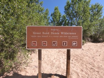
I was starting to regret splitting off of I-70 since it was adding miles and hours to my drive each day, but after a short drive the next morning to Great Sand Dunes National Park, it was worth it. Calling them dunes is an understatement. They are essentially sand mountains, although they are dwarfed in size when compared to the surrounding mountains.


The Great Sand Dunes are the largest in the United States, and they are full of recreational opportunities including sandboarding. I didn’t realize the popularity of sandboarding, but if you have giant dunes in your neighborhood, I guess that’s what you do. I didn’t see many people successfully sandboard (without falling down). There were a lot of people who brought their own boards. I suppose they climbed to the higher dunes for some extreme action, so I never saw their stuff. But most of the people that I saw sandboarding appeared to be trying it out for the first time.
It was Saturday and the weather was nice, so it was very crowded at the park. As you enter the dune area, Medano Creek (only a few inches deep) runs from the mountains into the valley and flows in front of the dunes. After you cross the creek there is an area of flat sand which creates a beach for visitors. The beach is where most people, especially kids, hang out and play. It was just like the ocean beaches; hundreds of people, umbrellas, coolers and boomboxes. If you walk through the beach area, the dunes begin to form, gradually increasing in size. Walking up the dunes is a chore, especially once you reach the higher points. Each time you plant your foot, it sinks down into the sand. It’s the proverbial two steps forward and one step back. I wasn’t planning on making it all the way up to the high dunes, but once I saw the trail of people determined to summit the sandy slopes, I decided to join them.

Everyone is short of breath at the top of the high dunes. It’s a steep climb and your steps are cut in half due to the sinking sand. Once I got to the top of what I thought was the highest dune in the park, I asked the guy next to me if this was the highest dune. He pointed off in the distance and said, “I think it’s that one” Still short of breath, I then made a noise that I have never made before. I guess you would spell it “hwyuh”. It was a sigh of exhaustion, combined with surprise and sarcasm. “That one” was only about a quarter of a mile farther. The Great Dune as it’s known. However to get to it from where I was standing, I had to go up and down several more dunes of similar size. I was okay with my summit for the day, and I knew I needed to get on the road.
I then proceeded to my descent. As difficult as they are to climb, the dunes are remarkably easy to descend. The larger dunes are steep, but some daredevils run down them, on the steepest face. The guy who pointed out the Great Dune to me ran down (see picture below). It didn’t seem safe or even possible to do this without falling. However it works because each time you plant your foot, just as during the climb, your foot sinks into the sand. It’s as if your feet have suspension and the sand absorbs the shock with each step. So a 20 minute climb, turns into about a 1 minute descent. All that work to get to the top! The view and the unique landscape are the real rewards, although it is fun to run down.

Medano Creek and the “beach” 
The queue for the summit 
He was in there pretty deep, but this guy eventually was able to climb out 
View of the beach and mountains from the high dune 
Reminiscent of the Sahara 
Walking down in the dunes, the mountains are eclipsed by sand 
Guy running down the dune 
The Great Dune (far middle) with 2 people at the summit
Bound for Utah
After the pilgrimage to the top of the dunes, I got on the road bound for Utah. It was a quasi-goal to reach a new state every day. The problem with this goal is that the farther west you go, the bigger the states become. I started on a route that took me through Durango, however I changed my mind at the last minute and decided to drive north first toward Buena Vista. Even 20 minutes after I left the dunes, I could still see them from afar. The landscape in the valley is so flat and the dunes are so massive, it’s difficult to get out of view of the dunes.
I don’t think there is a bad route to drive through Colorado. Once you are west of the Front Range, driving through any valley should give you incredible views. My route took me up US 24 with the Sawatch Range to my left. Great pick for the driver! I passed by the Collegiate Peaks (named after the Ivy League Schools) and Mount Elbert (the tallest mountain in Colorado). I then drove through Leadville (highest town in the country) and eventually made my way back to I-70 in between Avon and Vail. I could have turned onto route 82 and passed through Aspen (which would have been a shorter drive), but I think I was distracted by the mountains and lakes so I kept driving on route 24. I highly recommend taking US 24, especially from I-70 to Leadville. If you are in Colorado and looking for a scenic drive, you will not be disappointed. Although as I stated earlier, I don’t think you can pick a bad route through Colorado.
North of Leadville, you cross the Western Continental Divide at Tennessee Pass. It was so cool driving at an altitude over 10,000 feet. You can’t even get close to that elevation on the east coast. From the the divide I continued on to I-70 and turned west. As you drive toward Utah, the landscape gradually turns more arid. After you pass through the Grand Valley, you see less mountain peaks and more mesas. The rocks also change from grey to red. I-70 weaves back and forth across the Colorado River heading toward Utah. There are several twisting sections between the canyons and tunnels through rock faces, you almost wonder why they routed the interstate this way. I finally saw some wildlife. There was a small herd of bighorn sheep on the side of the highway right after I exited one of the tunnels. No bears or elk yet.

Mount Elbert 
Tennessee Pass 
Red Cliff, near the Eagle River
I crossed into Utah and took one of the first exits toward Westwater, a BLM campsite. I didn’t realize it was 10 miles off the interstate, but the campsite sits right along the Colorado River which I thought would be a neat spot to stay for the night. Unfortunately, the mosquitos thought this too. I was unable to use my rooftop tent at the site, so I had to set up camp the old fashioned way with my backup tent while constantly spraying for insects. I quickly made dinner and ate inside my tent to minimize my mosquito bites. I was exhausted too. The sun was on me all day and I drove over 300 miles. After my meal, I quickly fell asleep. The ground was rock solid so I couldn’t stake my tent, even when pounding the stakes with a rock. I was okay with that, as long as the wind wasn’t as vicious as it was in Dolly Sods. Despite the insect issue, it was nice sleeping with the sound of the river flowing by.

Love the pictures! The sand dunes look amazing.