
Distance: 7.6 miles
Hike Time: 3.5 hours
Elevation Gain: 1,900 feet
Old Forge to Pen Mar is moderately strenuous with a few big climbs. Heading South (like we did) it’s a net uphill of about 400 feet. However as a reward for hiking Southbound you get to finish with an excellent view of the Appalachian Valley at Pen Mar Park. On the other hand, if you hike North you have a net downhill and finish at a nice park and picnic area at Old Forge.
We didn’t see much wildlife, although while driving to Old Forge we drove by a bear that we assumed had been struck by a vehicle. Our next turn after the dead bear was literally called Beartown Road. Needless to say, you are in Bear Country here. Michaux State Forest encompasses much of this hike so the bears and other furry woodland creatures are “protected” and abundant.
As I have mentioned before, Pennsylvania takes very good care of their trails (as opposed to their roads). The many foot bridges constructed to cross the creeks and the access points to the AT were very well-maintained.
Map
Continuing the AT in sections
Lately we have been making great progress on completing the AT in day-hike-size bits. We postponed taking on the roller coaster section of Virginia temporarily to take on the Southernmost section of Pennsylvania . We hiked up to this point a few months ago. This section I completed with my buddies Dave and Josiah.
Starting Point – Old Forge
Since I rendezvoused with my hiking buddies at Pen Mar Park, we drove one vehicle to Old Forge Picnic Grounds in Pennsylvania and made it our starting point for the day. Old Forge is a sprawling park with almost too many picnic benches and the park is very well maintained. Again, Pennsylvania takes good care of their parks. They even had free water at the trailhead (available year-round).

Ideal Conditions
In the middle of June, you would expect the weather to be warmer. We started our hike with a very mild temperature in the low 60s. After warming up on the first hill, it was perfect weather. Humidity was remarkably low since it rained the previous night. I digress.
Southbound from Old Forge to Pen Mar
Heading South from Old Forge, the first couple of miles are very peaceful. This section is not really remote, but it felt like it. We didn’t see many folks at the Northern end which added to the remote feeling. Just south of Old Forge is the crossing of Antietam Creek.
Deer Lick shelters
After a few steepish climbs, the trail generally follows the ridge for about 2 miles leading to Deer Lick shelters.
Deer Lick has two small shelters (I think one was relocated recently). They could combine to the equivalent of one standard shelter. There are campsites and a spring farther from the trail. No trail log book was present in either building.

Springs, creeks, and road crossings
About a mile South of Deer Lick is a spring signed just off of the trail. The water looked a little stagnant and the spring wasn’t really flowing. But I suppose that’s why you take a filter.
South of the spring is the first of six road crossings on the way to Pen Mar. At Buchanan Trail (Route 16), a scruffy-looking guy emerged from the parking lot. He looked a little suspicious, but we said hello. As we made our way back into the woods, we realized that he was leaving supplies for thru-hikers; some “Trail Magic”.

After one more road crossing and climbing around Mount Dunlop (the highest point in this section), we made our final descent into Falls Creek. On the downslope to the creek, we passed through the densest patch of Mountain Laurel for the day; another peaceful part of the trail.


The final creek and road crossing occur at Falls Creek and Pen Mar Road respectively. Just before crossing the railroad is the famous Mason-Dixon Line and Mailbox on the AT.

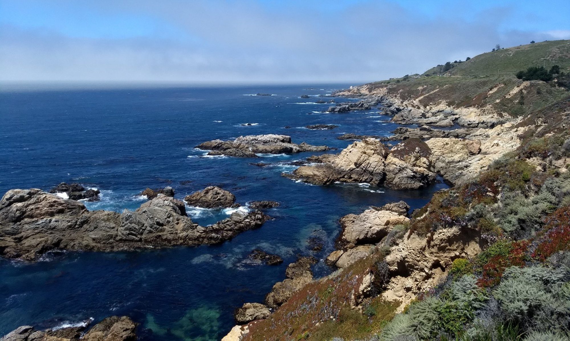
The last hill is a little steep, but after crossing over the railroad and finishing the last 1/4 mile on flat ground, there is a great overlook awaiting you at Pen Mar Park.

Roadkill
When you are on the AT, it’s safe to assume you are in bear country. Even though it’s a little dangerous encountering a black bear, I always want to see a bear when I’m hiking on the AT. After our hike we stopped by the road where we saw the dead bear in the morning.
It was still there. Someone had left a note saying that animal control (or maybe the local taxidermist) was coming to pick it up. It was a younger male so at least no Mama Bear was leaving any orphan cubs. Hopefully next time we can see a live one on the trail.
